
File:Manhattan map.jpg
Size of this preview: 327 × 599 pixels. Other resolutions: 131 × 240 pixels | 262 × 480 pixels | 729 × 1,335 pixels.
Original file (729 × 1,335 pixels, file size: 256 KB, MIME type: image/jpeg)
Summary
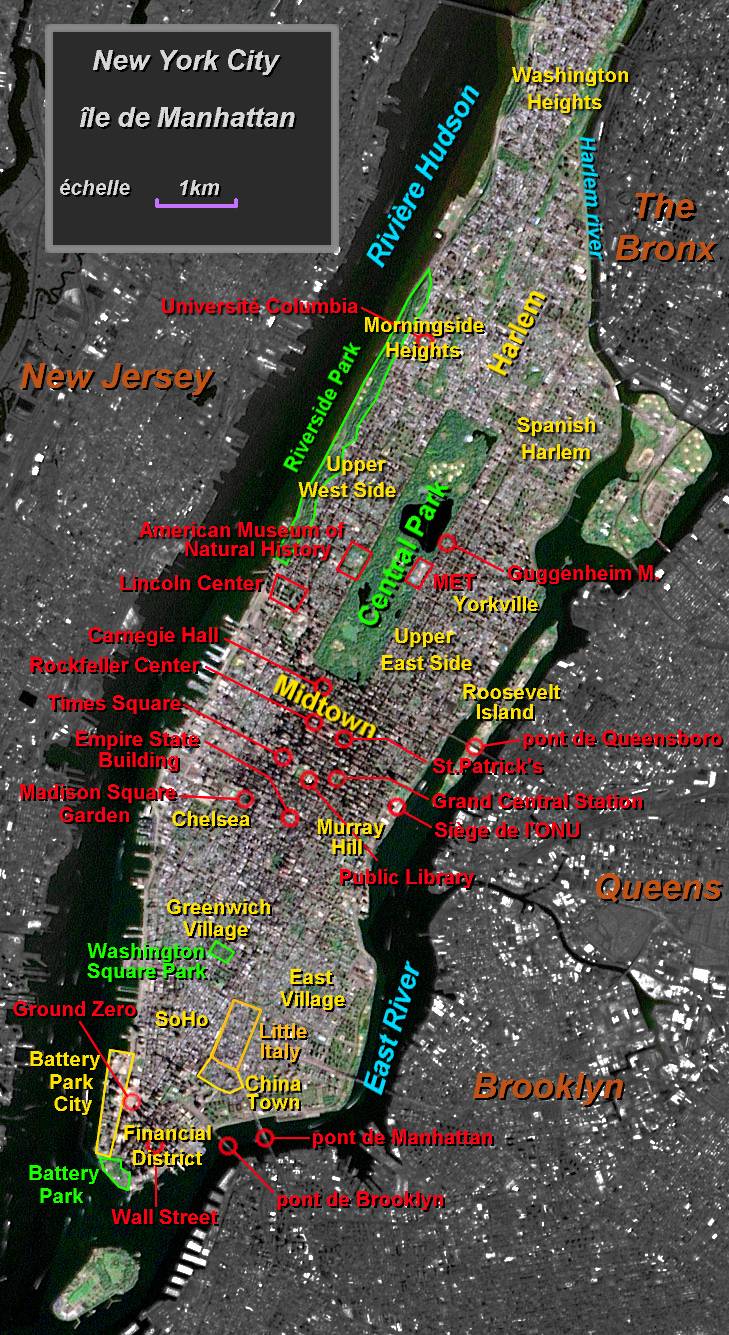
| Description | Manhattan map |
| Date | |
| Source | photo USGS EROS Data Center Satellite Systems Branch, legend by Luna04 |
| Author | Luna04 |
| Permission (Reusing this file) |
Released under the GNU Free Documentation License. |
| Other versions | fr:Image:Manhattan map.jpg |
Licensing

|
Permission is granted to copy, distribute and/or modify this document under the terms of the GNU Free Documentation License, Version 1.2 or any later version published by the Free Software Foundation; with no Invariant Sections, no Front-Cover Texts, and no Back-Cover Texts. A copy of the license is included in the section entitled GNU Free Documentation License. |
| This file is licensed under the Creative Commons Attribution-Share Alike 3.0 Unported license. | ||
| ||
| This licensing tag was added to this file as part of the GFDL licensing update. |
Original upload log
(All user names refer to fr.wikipedia)
- 23 juillet 2004 à 21:27 . . Luna04 (Discuter | Contributions) . . 729×1335 (261 663 octets) (Carte de Manhattan - New York (quartiers, sites et parcs). Réalisation personnelle sur fond de photo satellite du domaine public NASA/USGS Credit Image provided by the USGS EROS Data Center Satellite Systems Branch. Publiée pour Wikipedia en GFDL {{GFDL)
File history
Click on a date/time to view the file as it appeared at that time.
| Date/Time | Thumbnail | Dimensions | User | Comment | |
|---|---|---|---|---|---|
| current | 22:30, 3 July 2006 | | 729 × 1,335 (256 KB) | wikimediacommons>HenryS | {{Information |Description=Manhattan map |Source=French Wikipedia Images |Date= |Author=USGS EROS Data Center Satellite Systems Branch |Permission=NASA/USGS Public Domain |other_versions=fr:Image:Manhattan map.jpg }} |
File usage
The following page uses this file: